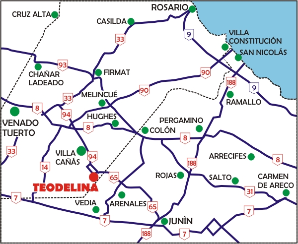
How arrive to Teodelina?...
See larger map
Reference Data:
The area of the District of Teodelina is 730km2.
Teodelina is located:
34ş12’ de South Latitude.
61ş32’ de Length.
Teodelina is:
88 meters above sea level.
Teodelina lies:
341 km. of Autonomous City of Buenos Aires.
382,6 km. of City of Santa Fe.
205,4 km. of City of Rosario.
Location
Teodelina is located on Provincial Route No. 94 that meets Villa Cańas, Santa Isabel and
through it connects with National Route No. 8, to Provincial Route No. 33 and to Provincial Route
No. 186; all this within the Province of Santa Fe. As being a border town, precisely, in
union with the district-General Arenales, Province of Buenos Aires, Route Nş 65 of that jurisdiction
leads us to Junin, at this point connecting with National Route No. 7. Distrit of Teodelina has
a large quantity of rural roads, and the most important link us with the localities of San
Gregorio and María Teresa in the Province of Santa Fe, and Vedia, Alberdi y Colón in the Province of
Buenos Aires. The rail network belongs to Gral. San Martín's Rails, passing through Teodelina's
Station and binds to the National Railway System.
|